Tuesday, November 29, 2016

November 9, 2016

excerpt from:

http://www.nytimes.com/2016/11/10/us/politics/trump-speech-transcript.html?_r=0

"...We are going to fix our inner cities and rebuild our highways, bridges, tunnels, airports, schools, hospitals. We’re going to rebuild our infrastructure, which will become, by the way, second to none. And we will put millions of our people to work as we rebuild it...."

Saturday, October 29, 2016

D Willinger June 30, 1999 Comments Miller Highway Relocation


https://books.google.com/books?id=oaM1AQAAMAAJ&pg=PA353&dq=westway+highway+project+eis&hl=en&sa=X&ved=0ahUKEwjC56rDi93MAhXKRiYKHQUyDWYQ6AEIMjAE#v=onepage&q=westway%20highway%20project%20eis&f=false


Pp 175-177 MILLER HIGHWAY PROJECT June 30, 1999 public hearing transcript

Hello.  My name is Doug Willinger. I’m a Founder of the Takoma Park Highway Design Studio. Where I’m working on a web site to show the differences between community friendly

I ask a rhetorical question of the people here: Who hear likes Grand Central Station?  Who here would have been against building Grand Central Station early in this century?  Well, Grand Central Station was built upon the site of the original grand Central Station, which was only about 30 years old and had been rehabilitated in 1898 only 6 or 7 years, before they tore it down.  This is nothing new here.  This is about change for the better.

I am very dismayed to see people here arguing in favor of an elevated highway that if it were anywhere else they’d be opposed to it.  If they had it going all the way down to the Battery Park, they would be crying to tear it down.  We need to move ahead with this.  We need to stop giving in to the type of poor planning that actually had us not build this tunnel 10 years ago and we threw away a great opportunity on the West Side to build something that could have benefited everyone with the highway tunnel and with light rail on top.

If we really want to save money today, why don’t we suspend the current 9A project and restart it up with a surface-level trolley on top and a highway tunnel beneath, because we’re going to come to the conclusion [in] about 10 years to tear it up and do it again right.  Let’s do this project right as it’s being proposed and move ahead with it.

I suggest that a lot of the opponents here will be joining on top of that thing with supporters when it is done and saying, yes, this was good.  You’d be against Riverside Park.  You’d keep it an open rail yard with the types of arguments that we are hearing today.  Let’s move ahead and let’s move beyond the hysteria.  Thank you very much.

The authorities would not go ahead with this project in 1999, largely because the elevated segment of freeway this tunnel would replace, had been refurbished only about a decade earlier.

However, segments of this replacement tunnel were subsequently constructed starting about 2006, as such would be directly beneath the new southern extension of Riverside Drive alongside the Trump development, thus saving money in so far as avoiding having to tear up that area to construct the tunnel later.

Unfortunately that general idea was not adopted with the 9A 12th Avenue/West Street project which constructed an all new roadbed, which if it could not be delayed for a tunnel, should at least been constructed with the necessary sub-supports to allow the subsequent excavation for a tunnel, to avoid the waste and disruption of having to tear it up for such.


.

Saturday, September 24, 2016

Brooklyn-Queens RX


- Gowanus Tunnel Deferred for A Few Decades- existing viaduct being reconstructed

- Feds Deny BQE Tunnel that would provide useful extra capacity

- Proposals for IRT expansion languish

Best Bang For the Buck-

Construct Linear Park Covered Cut & Cover Tunnel Interboro-Cross Brooklyn Expressway/Cross Harbor  With IRT X Line via the New York Connecting RR Corridor


Reconstruction of underutilized RR 
into linear park atop multi purpose cut and cover transportation facility 
to better serve and connect the boroughs and the region


- Reconstructs existing under-utilized New York Connecting Railroad

- Constructs New Linear Park Atop Multi-Purpose/Railway-Expressway Cut and Cover Transportation facility

- Provides modernized-expanded freight rail, plus new IRT X Line from northern Queens southward to east-west through Brooklyn

- Provides an all new parallel vehicular route to the Brooklyn-Queens and Gowanus Expressways, avoiding construction disturbances to traffic upon those roads, and ultimately ease their future reconstruction, as well as better serve JFK Airport.

- Provide a much needed vehicular expressway route and IRT subway line across central Brooklyn

- Provides options for extensions:
-- westward via an all new Cross Harbor Tunnel,

-- northward via new tunnel connections to the Bronx,

-- eastward via IRT spur to JFK Airport.


Interboro Expressway was planned during the 1960s, included modernizing the existing IRT Carnesie line.

Cross Brooklyn Expressway was planned during the 1950s and 1960s to be routed by the Bay Ridge LIRR corridor, with different ideas for fitting it within the corridor's 80 foot wide middle segment, by the mid 1960s as a multi-level elevated facility, and by the late 1960s with multi-level cut and cover tunnels with new IRT line and new development atop, known as the 'Linear City' proposal.

IRT X Line is being promoted by the Regional Planning Association. It would run via the combined corridors of those previously planned for the Interboro Expressway and the western portion of the Cross Brooklyn Expressway, thus including the IRT line that had previously been planned as part of the proposed Cross Brooklyn Expressway-Linear City Project.

Both the Interboro and the Linear City Cross Brooklyn Expressway proposals were cancelled over 4 decades ago: the Interboro in 1973, and the Cross Brooklyn/Linear City in 1969 as part of then NYC Mayor Lindsey's mass cancellations of the city's yet to be built freeways.

This proposal would combine a revived Interboro and Cross Brooklyn Expressways with an IRT X line conceivably expanded to include a spur to JFK Airport, in a design building upon what was developed with the previous 'Linear City' proposal, with the concept of enclosing the Expressways and the Railroads within box tunnels, but with a continuous linear park.

It would start the Interboro at the New York Connecting Railroad junction with the I-278 approach to the Triborough Bridge, reconstructing that segment to create the new junction.

The Cross Brooklyn Expressway would be built to accommodate extensions to the west and to the east, respectively: a Cross Harbor Tunnel to I-78 in New Jersey, featuring vehicular expressway and rail lines (freight and IRT); and a Expressway and IRT continuation to JFK Airport, and beyond via the east-west portion of the Belt Parkway with added carriageways and decking, to the Sunrise Highway Corridor.

Provides new enhanced transport corridor facility via existing underutilized corridor roughly paralleling the existing BQE-Gowanus, without requiring any disruptions to that existing corridor-facility; and ultimately could accept traffic diverted from that existing corridor-facility to make the later reconstruction of such more practical.  It would be easier to eventually construct a tunneled replacement for the BQE-Gowanus when there is a parallel facility to divert much of the traffic.  Would likewise provide such a benefit to the VanWyck Expressway, facilitating the latter's eventual reconstruction with greater capacity and undergrounding.

Wednesday, August 31, 2016

Freeway Removal Ideology to Influence GREATER Displacement?

Combined with idea of maintaining existing capacity levels.

New plan for Houston, Texas, to remove freeway link and replace with extra capacity along another via widening to INCREASE eminent domain use- property displacement!

Would eliminate the southern portion of the Pierce Freeway - an elevated segment of I-45 -- and reroute such along I-10 and I-69 respectively along the northern and eastern sides of the central business district, requiring their widening..


http://usa.streetsblog.org/2016/06/29/houstons-big-chance-to-turn-back-the-tide-of-car-traffic/

The article makes much ado about the removal of the southern portion of the Pierce Freeway, the elevated viaduct just to the west of the Houstan CBD.

Currently,  I-45 comes down from the north, crossing to the south of east-west running I-10, before turning south-easterly to cross to the east of I-69.

The new plan would have I-45 instead turn to the east along I-10, before then turning to the south/south-west along I-69, before then turning to its existing path to the south-east.

The northern portion of the Pierce would remain as a 'downtown connector'.

"On the bright side, TxDOT is proposing to tear down the Pierce Elevated Freeway, which could open up 20 to 50 blocks of downtown for walkable development. The plan also calls for aligning I-45 with U.S. 59 to the east of the city, burying the roads in a trench capped with a park.

“The impacts on walkability and urbanism are real and are a big deal,” said Jay Crossley, former director of the smart growth advocacy group Houston Tomorrow. “If they could only do those parts of the plan it would be an amazing plan.”


The idea of reconstructing U.S. 59 (which is co-signed as I-69) and currently an 8 lane elevated viaduct into a new trench beneath a new cap is a good one.

But what about that of doing that as a significantly wider Route 59/I-45/I-69 freeway, thus requiring substantial property acquisitions in order to replace the capacity lost with the removal of the Pierce Freeway?

The other portions of the downtown freeway system to be reconstructed would retain their existing basic configurations- aka surface and elevated, while gaining capacity.

Should not freeway reconstruction aim to not only maintain or increase capacity but also to change the configurations - aka reconstructing below ground - to improve local connectivity and otherwise mitigate local environmental impacts?

What consideration has been given to doing so by lowering and eventual covering of the Pierec Freeway?

Saturday, July 30, 2016

America on the Move - RNC Platform 2016


https://prod-static-ngop-pbl.s3.amazonaws.com/media/documents/DRAFT_12_FINAL%5B1%5D-ben_1468872234.pdf

pp 4-5

America on the Move Our country’s investments in transportation and other public construction have traditionally been non-partisan. Everyone agrees on the need for clean water and safe roads, rail, bridges, ports, and airports. President Eisenhower established a tradition of Republican leadership in this regard by championing the creation of the interstate highway system.

In recent years, bipartisan cooperation led to major legislation improving the nation’s ports and waterways. Our Republican majority ended the practice of earmarks, which often diverted transportation • REPUBLICAN PLATFORM 2016 • 5 spending to politically favored projects.

In the current Congress, Republicans have secured the longest reauthorization of the Highway Trust Fund in a decade and are advancing a comprehensive reform of the Federal Aviation Administration to make flying easier and more secure.

The current Administration has a different approach. It subordinates civil engineering to social engineering as it pursues an exclusively urban vision of dense housing and government transit. Its ill-named Livability Initiative is meant to “coerce people out of their cars.” This is the same mentality that once led Congress to impose by fiat a single maximum speed limit for the entire nation, from Manhattan to Montana. Our 1980 Republican Platform pledged to repeal that edict. After the election of Ronald Reagan, we did. Now we make the same pledge regarding the current problems in transportation policy.

We propose to remove from the Highway Trust Fund pro - grams that should not be the business of the federal government. More than a quarter of the Fund’s spending is diverted from its original purpose. One fifth of its funds are spent on mass transit, an inherently local affair that serves only a small portion of the population, concentrated in six big cities. Additional funds are used for bike-share programs, sidewalks, recreational trails, landscaping, and historical renovations. Other beneficiaries of highway money are ferry boats, the federal lands access program, scenic byways, and education initiatives. These worthwhile enterprises should be funded through other sources. We propose to phase out the federal transit program and reform provisions of the National Environmental Policy Act which can delay and drive up costs for transportation projects.

We renew our call for repeal of the Davis-Bacon law, which limits employment and drives up construction and maintenance costs for the benefit of unions. Recognizing that, over time, additional revenue will be needed to expand the carrying capacity of roads and bridges, we will remove legal roadblocks to public-private partnership agreements that can save the taxpayers’ money and bring outside investment to meet a community’s needs. With most of the states increasing their own funding for transportation, we oppose a further increase in the federal gas tax. Although unionization has never been permitted in any government agency concerned with national security, the current Administration has reversed that policy for the Transportation Security Administration. We will correct that mistake. Americans understand that, with the threat of terrorism, their travel may encounter delays, but unacceptably long lines at security checks can have the same impact as a collapsed bridge or washed out highway. TSA employees should always be seen as guardians of the public’s safety, not as just another part of the federal workforce. Amtrak is an extremely expensive railroad for the American taxpayers, who must subsidize every ticket. The federal government should allow private ventures to provide passenger service in the northeast corridor.  The same holds true with regard to high-speed and intercity rail across the country. We reaffirm our intention to end federal support for boondoggles like California’s high-speed train to nowhere [sic- San Francisco and LA are hardly "nowhere"s].


Thursday, June 30, 2016

Roman Catholic Neo Medievalism vs Protestant Sprawl


http://www.andrewalexanderprice.com/blog20130330.php#.VKwus3uM6So

Two contrasting examples of development style in early America history are Williamsburg, Virginia and St. Augustine Florida. The latter founded and designed by the Spanish in traditional city style, narrow streets, plazas and such, while the former founded and layed out by the English with wide streets, wide lots with lawns, etc. You can guess which was adopted. I've been to both and much prefer St. Augustine. I suppose the ready availability of cheap plentiful land around Williamsburg versus the swampy land around St. Augustine is one reason for the difference in design adopted.

Williamsburg- founded by Protestants.

St. Augustine- founded by Roman Catholics.

Friday, May 6, 2016

Proposal: A Sheridan Expressway Deck - Westchester Avenue to 174th Street Vicinity:

Sheridan Expressway Deck - Westchester Avenue to 174th Street:

To construct a new boulevard on a deck atop the existing surface segment of the Sheridan Expressway, in the area between Westchester Avenue and 174th Street, taking advantage of the topography of the hill to the west, as an alternative to the plan to convert that existing freeway segment to a boulevard that would still be fed directly by freeways at both ends.

Existing planning fails to look to the long term of greater population densities and development in the South Bronx, and other factors that all point to increased use of the Sheridan Expressway over the future decades.

It fails to adequately consider massive new development in the Port Morris area, including that envisioned by the Re-Think NYC proposal to extend LaGuardia Airport into Port Morris, Hunts Point.  It likewise completely fails to consider the significant amount of new development achievable with a future project to demolish the Sheridan Expressway's southern elevated segment, and that which it connects directly, the hideously ugly elevated Bruckner Expressway, placing it with a line of new buildings flanked and atop a new underground replacement, with the parallel RR likewise decked over.

It likewise fails to adequately consider massive new development with the development envisioned for the Mott Haven area, along the parallel route to the Sheridan of the Deegan Expressway.  In particular, it ignores the ramifications of the recent decision to not widen the Deegan corridor for merge lanes instead providing such by re-striping the out lanes as merge lanes, thus reducing the number of through lanes from 3 to 2.  So narrowing the Deegan, while refusing to consider any long term design modifications for it, is only likelier to shift some of the truck traffic to the Sheridan.

It wastes the sunk costs of the existing Sheridan Expressway roadbed that was recently torn out and completely replaced with a high quality concrete roadbed to accommodate decades of future heavy truck traffic, as it would again rip out the roadbed in order to build a new boulevard upon a narrowed right of way, so narrowed to increase the real estate development square footage to the east.  Apparently, no costs comparisons were considered of the lost value of the to be demolished roadbed, versus the added cost of a deck over of the adjacent railroad along the west side of the Bronx River northward from Westchester Avenue to provide the extra development space.

It furthermore likewise squanders the additional opportunity to increase the square footage for new development by having the new buildings partially cantilevered over the space of the service roads.

It does all of this with the idea of accommodating new neighborhoods envisioned alongside in new large apartment-condominium buildings along a Sheridan boulevard that would remain directly fed by expressways at both ends, and thus have far higher levels of vehicular traffic, and such conflicts with pedestrians, than a boulevard upon a deck atop the existing Sheridan retained as a continuous expressway.  Retaining the existing expressway beneath this deck between Westchester Avenue and 174th Street would keep the bulk of vehicular traffic off of the new boulevard thus rendering it a far far more neighborhood-pedestrian friendly street- a point completely overlooked in all of the mania about 'freeway removal'.

It wastes the opportunity to reduce the costs of doing so, by planning this new development together with retaining the expressway beneath the deck, potentially reducing its costs by designing such buildings to serve as the outer walls and supports of the expressway deck, with the buildings so designed to have their '1st' floors facing the top of the deck, with the existing ground level as service entry points, such as for truck delivery.  Doing this now would certainly be far easier and less expensive than in the future either disrupting traffic to dig a cut and cover tunnel, or constructed a deck and having to modify the buildings to raise their street level entryways one floor up (while not retaining the utility of having the service road as an underground delivery points).

It perpetuates a wasteful trend of reducing express transportation corridors for the sake of development, as with the nearby truncation of the Dyre Avenue IRT line (former N.Y. Westchester & Boston RR) at Lebanon Street, severing it altogether from its southern continuation to Westchester Avenue and Hunts Point.

Demolishing the existing surface segment of the Sheridan to construct a narrower boulevard that remains directly fed by freeways at both ends is neither necessary or desirable for the laudable goals of creating new neighborhoods along the Bronx River that would be far far better served by retaining this expressway segment beneath a new deck featuring a new boulevard that would serves as a far more neighborhood-friendly surface street, while providing a significantly superior express highway network for the region that acknowledges the significant new infill urban development for the City.

http://cos-mobile.blogspot.com/2016/04/sheridan-boulevardization-persists.html


Sunday, May 1, 2016

1955 Mid Town Manhattan Expressway Elevated & Tunnel Options

from the "Joint Study of Arterial Facilities - New York - New Jersey Metropolitan Area" - January 1955, by The Port of New York Authority and the Triborough Bridge and Tunnel Authority TBTA: Robert Moses Chairman; George V. McLaughlin; William J. Tracy; George E. Spargo - General Manager and Secretary:

PNYA: Commissioners: New York: Howards S. Cullman, Chairman; F. Moran; Bayard F. Pope; S. Sloan Colt; Charles S. Hamilton, Jr.; Chas H. Sells; New Jeresy: Donald V. Lowe, Vice Chairman; Horace K. Corbin; John F. Sly; Jess Harrison Davis; David Van Alstyne, Jr.; Dow H. Drukker, Jr.


This 1955 book featured two options for constructing an east-west Mid Town Manhattan Expressway- Elevated and Tunnel.

Owing to its preference for elevated roadways over those in tunnels, this 1955 report addresses the elevated option first.


Elevated:

The 1955 study's option of an elevated version of the Mid-Town Manhattan Expressway, in a nutshell

3 lanes per direction upon a 100 foot (1/2 block wide) new swath right of way across Manhattan along 30th Street's southern side, except for the 2 and 1/2 blocks between just west of 10th Avenue and nearly midway between 8th and 7th Avenue where it so ran along 30th Streets northern side.

Interchanges situated at the west and east, plus three between:

- at the west with the Lincoln Tunnel and West Side Highway, plus a westbound off ramp and eastbound on ramp at 12th Avenue.

- at the east with the Queens Mid Town Tunnel and the East River Drive, plus a westbound on ramp and eastbound off ramp at 2nd avenue, with the latter ramp also to 1st Avenue.

- 2 additional interchanges respectively between 5th Avenue and Broadway, and 6th and 7th Avenues- each with left hand access ramps within the media space for better space utilization, with the option of being designed to support a line of new buildings, with elevator access via the median area.

Elevated Version of Mid Town Manhattan Expressway 
with Left hand ramps in Median

Would include the option of support provisions for ultimately constructing a line of new buildings atop the elevated expressway.  These buildings would be served by elevators located within the median space, connecting below to the street level and perhaps beneath to the underground level set aside for automobile parking.

As a product of Robert Moses, who favored elevated structures over tunnels, the 1955 study predictably favored such for its suggestion for the Mid-Town Manhattan Expressway

An elevated expressway, from its connection with the West Side Highway, would start as a depressed highway in the center of a widened 30th Street to 10th Avenue. At this point, it would swing to the north side of 30th Street to make connections between 10th and 9th Avenues with the Lincoln Tunnel Third Tube approaches now under construction. After underpassing 9th Avenue, the six-lane expressway would rise to overpass 8th Avenue and continue across Manhattan as an elevated structure. Between 8th and 7th Avenues the roadway would recross 30th Street and occupy a one-hundred-foot right-of-way immediately south of 30th Street. After overpassing 2nd Avenue, the expressway would swing north to follow the 30th Street alignment as a four-lane elevated expressway to connections with the East River (FDR) Drive.

At 1st and 2nd Avenues, ramps would be constructed to provide access to and from the Queens-Midtown Tunnel via 1st and 2nd Avenues and the existing tunnel approach roadways. Access to the expressway would be provided in each direction in the section between 5th and 7th Avenues. 

If the expressway were constructed, it is estimated that it would be used to its estimated capacity of 24,000,000 vehicles a year. 

Air-Rights Development

The Joint Study indicated the feasibility of designing the elevated expressway to permit the construction of new buildings over the elevated portion of the expressway two three-lane roadways could be separated and elevators to serve the overhead development could occupy the space.  The access ramps to and from the midtown avenues could also be provided between the roadways.

In addition to the air-rights development, commercial space could be provided at street level and parking areas for 1,300 vehicles could be provided in basement areas under the expressway.  The revenues to be derived from such developments could be expected to protect the City from tax loses due to construction of the expressway.  It is doubtful that they would also contribute to the expressway cost.

Estimated Cost

It is estimated that the cost of the elevated expressway alone would be $77,000,000, of which $33,500,000 represents real estate.  If the expressway were designed to permit the overhead development, the cost would be increased by $14,000. 

Financing

Revenues from possible development over or within the toll-free expressway property would be of a minimum nature.  It would therefore be necessary to finance the expressway out of Federal, State and local funds.

Would include a basement level - unspecified if it were to be continuous along the entire length of the elevated segment - for automobile parking, with no apparent consideration of using such for additional through lanes, or simply for a cut and cover tunnel without the elevated roadways- suggesting a bias against tunnels.   Though this proposal was confined to its 100 foot wide new swath along 30th Street, adding that to that street's 60 foot wide building line to building line conceivably meant to a total possible right of way width of 160 feet.  Thus, a significantly wider expressway would have been feasible as a cut and cover tunnel within this 160 foot right of way.


Elevated for most of its length, its wester-most segment was to be below ground level in an open trench, with the expressway under-passing 11th, 10th and 9th Avenues, before rising up in the area to the south of the Beaux Arts James Farley Post Office Buildings, to cross over 8th Avenue, thus giving eastbound travellers a view of Pennsylvania Station (and the later constructed Madison Square Garden), and over-passing each of the successive north-south Avenues.

Its 100 foot width represented one half of the space between 30th and 29th Streets.  This would accommodate 3 travel lanes, each 12 feet in width in each direction, adding up to 72 feet, with no shoulders, plus a center median where the access ramps would be located, thus accessing the expressway to and from its leftmost lane in each directions- a design chosen as more space compact, as well as useful for locating elevators for new buildings to be erected above.  Its 100 foot width and center median located access ramps all represented efforts to reduce the right of way requirements (width), and the idea of erecting new buildings atop represented an effort to reduce the facility's long term property tax burden via replacing the buildings removed for clearing its path.


Tunnel:

The 1955 study's option of a tunneled version of the Mid-Town Manhattan Expressway, in a nutshell:

2 cut and cover tunnels, each with 2 lanes- westbound tunnel beneath eastbound running 30th Street; eastbound tunnel beneath westbound running 29th Street.

Interchanges situated at the west and east, with the added option of one more centrally located:

- at the west with the Lincoln Tunnel and West Side Highway, plus a westbound off ramp to 9th Avenue.

- at the east with the Queens Mid town Tunnel and the East River Drive, plus a westbound on ramp and eastbound off ramp at 2nd Avenue.

- more centrally with a set of ramps between 5th and Madison Avenues

The Tunnel option possessed the supreme advantage of requiring at most a fraction of the building displacement of the elevated option, as the tunnels would be located beneath the existing right of way of 29th and 30th Streets, with displacement, and thus displacement-replacement confined to the various access points.

Yet the 1955 report did not favor it, due to the greater stated projected construction costs and for providing only 2 rather than 3 lanes in each direction.


The Joint Study disclosed that while physically feasible, a vehicular tunnel across Manhattan Island in the same midtown area would be prohibitive in cost.

It would be necessary to build two separate tubes under adjacent crosstown streets. A two-lane eastbound tube could pass under 29th Street; a two-lane tube westbound under 30th Street. Ventilation buildings would be located in the block between 29th and 30th Streets fronting on the west side of 8th Avenue and the east side of Lexington Avenue. The least costly type of construction for such a tunnel would be the steel-bent and concrete subway-type, installed by cut-and-cover method.

The tunnel providing only two lanes in each direction would, of course, have only two-thirds the capacity of a six-lane expressway. Provision of more than two lanes in each tube is not feasible due to limitations imposed by building foundations on either side of 29th and 30th Streets and extremely high costs. Limited street access in Midtown could be provided in the vicinity of 5th Avenue at a cost that would depend on the degree to which the interchange was developed.


The tunnel providing only two lanes in each direction would of course have only two-thirds the capacity of a six-lane expressway.  Provision of more than two lanes in each tube is not feasible due to limitations imposed by building foundations on either side of 29th and 30th Streets and extremely high additional costs.

Estimated Cost

The estimated cost of a crosstown tunnel with no surface connections at Fifth Avenue would be approximately $119,000,000 including real estate.  The estimated cost with a single-lane entrance and a two lane exit, to and from the west only, at Fifth Avenue, would be approximately $134,000,000.  The estimated cost with single-lane entrances and two-lane exist in each direction at Fifth Avenue would be approximately $145,000,000.

The 1955 report is not entirely clear with its cite of "Provision of more than two lanes in each tube is not feasible due to limitations imposed by building foundations on either side of 29th and 30th Streets and extremely high costs".

A tube with 2 foot wide outer walls, with 2 lanes at 12 feet apiece and no shoulders would be 28 feet wide.

Adding a 3rd through lane would bring the width to 40 feet.

Yet the east-west streets are 30 feet wide from curb to curb, and a total of 60 feet wide from building line to building line.

30 feet is just enough for 2 continuous travel lanes, without continuous shoulders, though it would still be feasible to construct emergency pull over areas within the tunnels as they passed beneath the north-south avenues.

60 feet is enough for tunnels with 3 continuous travel lanes, plus a shoulder.

Alas, the report fails to distinguish between matters of building foundation stability, which could be compromised by an adjacent excavation removing the soil that helps frame the load-bearing foundations, a problem with smaller-older buildings; or if such foundations physically intruded into the space beneath the sidewalks, or rather, such foundations had adjoining vaults -- that extend beneath the sidewalks.

The buildings along 29th and 30th Streets appear to be a mix of different building types- a topic the 1955 report does not go into in any detail.

More information would be needed about the strengths of the foundations and the soil conditions, as well as any under-sidewalk vaults and the willingness to take a portion of such for the underground right of way, to better ascertain the feasibility of a somewhat wider tunnel.   As it is relatively doubtful that a building would actually have its load-bearing foundation beneath the sidewalk, the two likeliest issues would be soil stability for older buildings with weaker foundations, and those with underground vaults beneath sidewalk space.

As adding a third lane to a 28 foot wide tunnel structure would bring it to 40 feet in width, thus extending out 5 feet past the curb lines on each side, while leaving 10 feet on either side between its outer walls and the above ground building lines, the 1955 report arguably could have gone into some greater detail, especially considering the failure to discuss condemning a mere 5 foot underground easement along the outermost sidewalk space, and the feasibility of any necessary stabilization of nearby building foundations, while nonetheless favoring condemning a 100 foot wide swath of entire buildings for the elevated option!

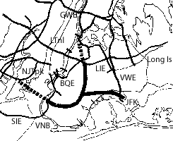
As can be seen from the 1955 study map renderings, building displacement for the Mid-Town Manhattan Tunnel would have been a fraction of the favored elevated option, being confined to its proposed transition points and its access ramp locations.  Transition points are shown for the eastbound tube in the vicinity of 10th and 9th Avenues, its approach to the 5th Avenue interchange westward to 6th Avenue, and to the east of Lexington Avenue to a one and one half block new swath cut to 2nd Avenue.  Such are shown for the westbound tube for the same cut from 2nd Avenue to Lexington, along the south side of 30th Street from midway between Lexington and 4th Avenue to the 5th Avenue interchange between Madison and 5th Avenue, and along the northern side of 30th Street from just east of 8th Avenue to the connection with the Lincoln Tunnel Expressway about midway between 9th and 10th Avenues.   Additional building displacement would be indicated for the north-south running connections located east of 3rd and 2nd Avenues to the the Queens-Mid-Town Tunnel.

 By ending its discussion about the reduced capacity of 2 rather than 3 lanes per direction with the phrase "extremely high additional costs" the 1955 report sidesteps any consideration of providing additional tunnel capacity by other means, not only with an inadequate discussion of the construction feasibilities, but also that of the potential staging.  It gave no apparent consideration for tunnels with more than a single level -- e.g. duel level tunnels each with 2 lanes atop 2 lanes providing a total of 8 lanes -- either constructed at once or staged with the eventual construction of an additional underground level.  Nor did it consider a design permitting a concurrent or staged set of additional parallel tunnels beneath the adjacent east-west streets- an omission matched by its lack of a full consideration of the costs of the displacement and replacement of the real estate costs of the elevated option.


An Anti Tunnel Bias:

Owing to the elevated option's significantly greater amount of displacement - aka demolition - of existing buildings, versus the tunnel option, the 1955 report certainly understated - to put it mildly - the local opposition entailed by such, not only upon grounds of disrupting existing building activities but as well architectural and historic preservationist concerns.  As doubtlessly each block in an area as densely constructed as Manhattan is going to include structures of significantly architecturally if not historic interest to engender significantly increased local opposition, as occurred with the western segment of the parallel proposed Lower Manhattan Expressway though So Ho displacing numerous architecturally interesting Cast Iron buildings, the report does not really address the matter of building loss really that adequately, as such concerns are not necessarily easy to quantify.  Rather it limits such consideration to the simple matter of property tax revenue, and hence does this with its proposal of constructing a line of all new buildings atop the elevated expressway, which would essentially run through these new building's 2nd floor.  Notably, it does not give a full cost comparison between the two options that would fully adjust for the relative construction costs including those of clearing a new 100 foot wide swath across Manhattan and constructing replacement buildings, versus the tunnel option's greater preservation of existing buildings.

For the option of clearing a new 100 foot wide swath for the primarily elevated option, the 1955 report gives a figure of $35.5 million for real estate property acquisition out of a total cost of $77 million - thus translating to construction costs of $43.5 million for the primarily elevated option, while noting an additional $14 for design provisions to permit the eventual construction of the new buildings atop - thus translating to $91 million total, for a 6 lane facility, not counting the costs of the replacement buildings.

For the option of a set of cut and cover tunnels beneath 29th and 30th Streets, with relatively a fraction of the amount of real estate clearing for the access points, the report fails to give a full breakout of construction and real estate acquisition costs.  For that it simply gave figures for a total cost of either $119 million, $134 million or $145 million, variable upon the access ramps in the vicinity of 5th Avenue, with the cheapest having no access ramps there, and the next having such ramps only to and from the west.

By neither breaking out the separate costs of the right of way and construction costs of the tunnel option, nor providing any cost estimates for the real estate replacement costs of the elevated for requiring the clearing of a new 100 foot wide swath, the report was biased against the tunnel.

Would such new buildings cost less, or more, to construct than the $35 million given as the cost of acquiring the existing buildings for the elevated option's 100 foot wide continuous new right of way, let alone the costs of adequately compensating the displaced numerous resident and businesses in so many buildings with adequate replacement building space before removing their existing buildings?  Such would be significantly costlier for a project clearing a new 100 foot wide swath across Mid Manhattan than the fraction of such displacement for a tunnel with its mainline beneath existing right of way with displacement limited to access points as ramps and transitions.  The report alas makes no discussion of this, failing even to coordinate such say with any of Robert Moses' plans for large scale real estate removal and redevelopment elsewhere within NYC.

By neither listing the replacement costs for the building, nor separating the construction and real estate acquisition figures for the tunnel, the report prevents a cost comparison that may show the displacement-replacement costs approaching if not exceeding the costs of excavation and construction of tunnels beneath 29hth and 30th Streets with a fraction of the displacement-replacement costs for the access and transition points.

With regard to the short term costs of right of way acquisition and construction, and long term costs such as property tax revenues, the report's failure to separate construction and real estate costs for the tunnel option, while likewise failing to list the costs of the replacement buildings of the elevated -- touted for restoring the long term costs of the loss of property tax revenue from the buildings displaced, represented a bias against the tunnel.


Today:

Reviving the elevated option, or any other such option requiring removing a swath of buildings across Manhattan, would be a political nightmare.  Conceivably, the elevated option with buildings atop would have been architecturally interesting.  However, its removal of a continuous swath of buildings across Manhattan, thus inevitably including numerous architecturally significant buildings, would render it quite likely to succumb to preservationist opposition, especially with the available alternative of the under-street tunnel option.

Reviving the under-street tunneled option would make immense sense.  It gets the job done with a fraction of the building displacement, within an enclosure to contain vehicular traffic noise and emissions- accommodating and reconciling greater and more diverse human activity within an existing footprint.

More recently developed construction techniques would only make it more feasible.

Slurry wall construction where the outer walls are constructed before the excavation between would make the project far more feasible, particularly with regard to areas alongside older/smaller buildings that lack the substantial foundations of newer/larger to withstand the nearby excavation's soil removal.

Furthermore, such slurry wall construction would better facilitate a subsequent top down construction, where a pre fabricated roadbed could be installed atop, before the main amount of excavation and construction of the full tunnel box and roadbed.

Hence it may be more practical for the tunnels to be somewhat wider, depending upon any sub-sidewalk vaults, and the willingness to partially remove such.

A tunnel tube with 2 foot wide outer walls, a pair of 12 foot wide lanes, plus an 8 foot right-hand shoulder would be 36 feet wide; and one with a 3rd travel lane would be 48 feet wide, beneath a 29th and 30th Street with a curb to curb with of 30 feet, and a building line to building line width of 60 feet. 

Lowering the tunnel an additional level could allow the main roadways to pass beneath any space for sub sidewalk vaults.  This could complicate the slurry wall construction by requiring removal and replacement of the underground vaults.  But it would provide the opportunity to locate access ramps within the existing street right of way to descend into a top collector-distributor tunnel level before swinging right and down to merge with the underground freeway, thus reducing the need for displacing buildings for access ramps.  Locating the access ramps within the center of a street - center loader ramps -- would not only avoid building displacement but be far more compatible with pedestrian and cyclist activity by avoiding the conflict of standard side loader ramps located upon either side of a surface street.  As 29th and 30th Streets run in the opposite direction of the tunnels that would be beneath, such ramps would have to turn to align with the north-south streets, unless of course the running directions of 29th and 30th Streets were swapped.  Avoiding building displacement in Mid Town Manhattan would to some degree off set the added expense of a deeper excavation.

With the slurry walls extending sufficiently deeper, a second through level below would allow twice the capacity, though due to space constraints, access ramps would be precluded, except towards its western and eastern ends, thus having this lower through level better cater to longer distance travel.

Top down construction would allow the top collector-distributor and the middle -- upper -- through level to be completed initially, permitting deferring construction of the lower level.

A set of twin tunnels beneath 29th and 30th Streets, each with 2 or 3 travel lanes and a right hand shoulder would provide 4 or 6 continuous through lanes, and with the lower level, provide 8 or 12 continuous through lanes.   The 60 foot building line width could conceivably allow just enough space for even the 3 lane version to have an additional lane for on and off ramp access merge.

The straight street grid of Mid Town Manhattan would make this under street vehicular tunnel project more environmentally practical then areas of NYC lacking such a grid.

New cashless tolling technologies would make funding this project far more feasible, and could vary the toll not only upon the time of day, but upon the distance via the installation of such toll readers upon the access ramps.


Saturday, April 9, 2016

Sheridan Expressway 'Boulevardization' Persists


Rejected in 2012, the idea of eliminating the Sheridan Expressway grade separation continues, with NY officials earmarking $97 million for removal, with a new report recommending that its northern, at grade segment be converted to a traffic light signalized boulevard, upon a reduced right of way.

http://www1.nyc.gov/site/planning/plans/sheridan-hunts-point/sheridan-hunts-point.page

Option #3 with right of way reduced to 115 feet
Orange marked cross streets, from bottom: Jennings, 172nd and 173rd Streets

This report displays a number of options for this segment, including narrowing the existing 210 foot building line to building line right of way to as little as 115 feet to facilitate greater amount of real estate square footage to the east.


Option #1 Retain existing 210 foot right of way with flanking service roads
Option #2 Modify-Separated 155 foot right of way, eliminated the eastern service road
Option #3 Modify-Combined 115 foot right of way, eliminates both service road


All of these options would transform the existing surface Sheridan Expressway into a traffic light signalized Boulevard.

Option #3 would essentially require demolishing the recently reconstructed Sheridan roadbed, in order to squeeze it to the west, displacing a separate West Farms Drive.

note that this is in the side of a hill.


Existing Sheridan profile looking north

Advocates for removing the Sheridan Expressway cite improved waterfront access and development, and reduced vehicular pollution as reasons.

But is adding traffic light intersections to what is now a grade separated express highway corridor, that is still fed by freeway segments at both ends between the highly used Cross Bronx Expressway and the Hunts Point Truck Depot really the best solution?


Previous calls for entirely removing the Sheridan Expressway were rejected with the finds that eliminating its grade separated "below grade" under-passing of Westchester Avenue would drastically increase traffic congestion and pollution at the alternative parallel route of the traffic light intersection of Westchester Avenue with Whitlock Avenue.  Meanwhile removing the Sheridan Expressway's "above grade" elevated portion to the south would transfer the traffic further along Whitlock, while doing nothing to address the parallel elevated 'subway' and surface railroad that now flank it and also separate the area from the waterfront.


1st stage of Northern Sheridan Area Re-development


Hence, the planning discussions now focus upon the Sheridan's northern segment.

Except for its transition to its underpass crossing of Westchester Avenue, this segment runs "at grade" along the surface.

And this focus is exclusively upon the idea of converting this Sheridan segment into a boulevard, equipped with three new traffic light intersections, one apiece for the crossings of Jennings Street, 172, and 173rd Streets, and flanked by rows of new buildings.

To the north, the existing grade separation beneath the 174th Street Bridge would be retained, along with the ramp connects to and from the Cross Bronx Expressway.

And to the south would remain the existing Sheridan Expressway, with its underpass crossing below Westchester Avenue, and further south with its elevated viaduct wedged between the railroad to the east, and the elevated 'subway' line to the west, feeding directly into the elevated segment of the Bruckner Expressway, which would have a new set of ramps to Hunts Point Market to better facilitate truck traffic.

And flanking this "Boulevardized" Sheridan segment, new rows of buildings to the west, where the topography rises as a hill, and to the east where it runs flat towards the Bronx River, would replace existing industrial uses and contain hundreds of new residential dwellings.

All of this is being touted as the best option to improving the urban landscape with new park-lands, neighborhoods and jobs, with significantly improved local access to the Bronx River waterfront.

Really?

New development facing the lower portion of the Bronx River with enlarged parkland and improved local pedestrian access are all laudable goals, even though displacing industrial uses which could nonetheless be relocated to perhaps Hunts Point.

But how honest is it to combine this with the idea of replacing this surface segment of the Sheridan Expressway with a "boulevard" with three new traffic light intersections, and to issue renderings showing that with 1,000 plus new residential dwellings and presumably far more pedestrians, with no increase in surface traffic upon the replacement Boulevard that would have to handle these new residents plus the vehicular traffic from the Expressway segments at both ends.


Looking North Along Farms Road Before and After The Removal of the northern portion of The Sheridan Expressway - an earlier proposal
Though the latter rendering has this portion of the Sheridan Expressway removed, though still fed by Expressway segments at both ends, and its space taken over by a new line of buildings, with over 1,000 new residential dwellings, it shows virtually no vehicular traffic.

And what about the pretense that its an either-or situation?  That re-development and improved local waterfront access is necessarily incompatible with retaining the Sheridan Expressway as assumed by this seriously misguided campaign to simply remove the Sheridan.

Have Sheridan Expressway removal advocates chosen to shut their eyes?  To fail to try imagining the best of both worlds, eliminating the Sheridan's undesirable local lateral separation, while retaining its desirable longitudinal grade separation of keeping the bulk of the vehicular traffic out of the surface street grid.  Instead just following an often overly simplistic and dogmatic trendy campaign of freeway removal?


Apparently so.

A Sheridan Expressway Tunnel would accomplish this best of both words, with express traffic underground, thus freeing up the surface more for local use.

Placing freeways underground is the best of both word's solution, but is often dismissed as too expensive or difficult.

But this actually a pretty egregious example of keeping one's eyes shut, of a freeway removal campaign  being deliberately obtuse.

Just look at the topography.

The Bruckner sits in a river valley, between the Bronx River to the east, and a hill to the west.

Note how Jennings, 172 and 173rd Streets descend to the existing West Farms Road.

Activists want to facilitate a locally improved environment with improved accessibility to the Bronx River waterfront, and new real estate developments on both sides of this Sheridan segment.

But they are retaining a major vehicular traffic corridor, and thus maintaining the surface separation of the Sheridan Expressway corridor, namely its daily flow of traffic particularly between the Cross Bronx Expressway and Hunts Point market.  Don't forget that this Sheridan segment would continue to be fed by Expressway segments at both ends, and that the area is only going to have far more activity with all of this new development, plus the new ramps to Hunts Point, to say nothing of such further south if the Re-Think NYC plan to add a new terminal to La Guardia Airport and its attendant new development at Port Morris comes to fruition.  Under such circumstances, ONLY a tunnel would achieve a 'Sheridan' surface street that would be truly more like a local surface street than a de-facto freeway.

So why the zero consideration of a 'tunnelization" of this Sheridan segment- especially given the topographical ease and feasibility of achieving this with such numerous cost advantages?

- Such as of NO new excavation.
- Such as of retaining the existing Sheridan Expressway roadbed that was recently replaced with a relatively high quality concrete construction- option #3 would require ripping this out and replacing it altogether.
- And the opportunity of facilitating this with the designs of the yet to be built flanking future real estate development.

Again, note how the streets from the west, Jennings, 172 and 173rd,  drop down to meet West Farms Road, where the planning envisions replacing the existing buildings with new taller/denser buildings, as well as along the eastern side nearer to the Bronx River.  And note that these new buildings flanking the Sheridan segment would be substantial, with significant foundation walls thus framing this Sheridan segment.

To make this Sheridan segment into a tunnel, while crafting a true boulevard on the surface, atop the existing road-bed, construct a new box tunnel enclosure-deck supporting a new surface boulevard atop, directly faced by the "1st" floors of the flanking new buildings, which could have their facing foundations serving as the outer walls of this new tunnel, retaining the existing flanking service roads as underground delivery access for these new buildings, with the streets from the hill to the west leveling out to meet this new boulevard, and a terrace to the east of this new development  facilitating the transition descent to the Bronx River water-front.

Constructing this deck would be an added cost, surely.

But employing the existing road-bed - remember that the option #3 promoted for increased space for real estate development requires ripping out and replacing the existing Sheridan Expressway road-bed - would be a cost savings.

And so would the idea of designing these buildings to serve essentially as the outer walls of this new 'tunnel' that would include the existing service roads potentially used for underground delivery access.  Doing this would furthermore allow the idea of reducing the initial construction costs by deferring the extra walls to coordinate off the now underground service roads from the now underground freeway.  As these buildings have not yet been constructed, designing them for this purpose, including having their '1st" floors to face this new surface boulevard would be infinitely more practical than a retrofit.

This new deck would start at some point to the north of 173rd Street, and extend south to the vicinity of Jennings Street, if not further to as far as Westchester Avenue, depending upon several planning decisions.  For instance it could extend as far north as the bridge which carries 174th Street, with its north-south 'Sheridan' Boulevard descending to connect to the existing West Farms underpass beneath this bridge, or perhaps continue upon its raised grade to a new at grade intersection with 174th Street, before descending to the north in order to connect to the existing underpass crossing of the Cross Bronx Expressway.  Or perhaps it could combine these options, extending to the 174 Street Bridge but with a descent to the existing West Farms Road grade, or even conceivably, extend a bit further north to cover over a portion of the eastbound Cross Bronx Expressway to the southbound Sheridan Expressway ramp.  Similarly, the extension to the south would involve some options, such as those regarding the southbound off-ramp.


By so retaining the existing Sheridan recycled as an underground highway in the least expensive manner possible with NO new excavation and freeway roadway replacement, with the existing highway enclosed in a new tunnel box constructed atop further facilitated by developer cooperation with the new buildings alongside --  in sharp contrast with Boston's Big Dig which actually relocated Boston's I-93 Central Artery in all new lowered tunnels --such an underground configuration would make the new development more pleasant and valuable, making such a lid more economically viable. 

That such an idea does not even appear in any of the great urban planning discussions,speaks volumes of the controlled, dogmatic and not very imaginative nature and political dynamics of such organizations as the Congress for New Urbanism.


http://www1.nyc.gov/assets/planning/download/pdf/plans-studies/sheridan-hunts-point/final_1_3_analysis.pdf


Wednesday, April 6, 2016

3/31/16 Collapse Spotlights India's Hideous Roadway Urban 'Flyovers'


While areas worldwide are constructing unobtrusive underground motorways, India goes in the opposite direction with flyovers- elevated roadways of varying merit, including those placed above city streets, mere feet from people's bedrooms, as this in Calcutta with the Vivekananda Road 'flyover'


"Work on the Vivekananda Road flyover, which started in 2009, has gained pace after a long lull. The flyover, that will connect Girish Park and Nimtala Ghat Street to Howrah bridge, would allow commuters to bypass the congested Posta crossing.

Construction had almost stopped last year because of technical problems as well as objections from residents who apprehended accidents because the flyover runs close to their homes, said the authorities of Calcutta Metropolitan Authority (CMDA)."

The 1.4 mile (2.2 kilometer) long Vivekananda Road Flyover is one of a series of such elevated vehicular road 'fly-overs' constructed in India in recent years, itself being started in 2009.


The Vivekananda Road flyover is perhaps India's most extreme example of cramming an express roadway through a densely built up urban area, and numerous other Indian flyovers seen in various articles available via the internet, such as this, appear to be far less inappropriately situated, for instance not placing motor traffic directly by people's residences.

As can be seen from a google ariel, it has two main segments that are largely completed, with a not yet finished connecting segment, that collapsed on March 31, 2016, bringing the project much new attention.


The collapse occurred at the segment where the street has a right of way kink at the intersection with  Rabindra Sarani, where the designers were thus forced to use a single vertical support with cantilevers on each side, rather than double vertical supports as done on the rest of the viaduct.

 
  Kinked Right of Way


Single Vertical Support with Cantilevered Arms


 Customary Twin Vertical Supports


http://indianexpress.com/article/india/india-news-india/the-sunday-story-flying-under/

I think it seems quite clear what the fault is that caused the overpass to collapse in Kolkata. I can see that it may have been bad welding and even more profoundly bad engineering design (or bad construction if the drawings were not followed). The right arm of the support that collapsed was constructed with only a center column and two cantilevered arms. All the others had two legs and were thus not so structurally risky. It appears that the right arm broke off first, and then the left arm – absent its counterbalancing weight – simply buckled. The fault seems to be with the engineers, and not just with the builders, as it seems to me to be a particularly weak detail that would be prone to buckling because the members that held up the whole deck appear to be made up with tubes with sheets of steel no deeper in section than the steel beams that supported the deck along its length, with their ends resting on this weak cantilevered post and beam. The bending force at the top of the column must have been terrific, but it would appear from the buckling that the bottom cord did not even cross over the top of the column, as the column penetrates through the pair of cantilevered beams to terminate at the top cord. Wow! The reports said that they had just poured the concrete deck in this section when it failed, so it was simply inadequately designed to carry the weight of the road, never mind the traffic that will eventually be on it. The anomaly in the pier design seems to be because the road went around a bend in the street with a roundabout underneath – thus they did not want two legs on the support structure, but that has proved to be a mistake of gigantic proportions. The claims that this was an “Act of God” in my mind are incredibly misleading. Signed Randolph Langenbach ()

The above statement presumes that God acts only singularly and not sequentially, but is otherwise valid.

Though the collapse occurred at this naturally more vulnerable area, the project in general, and some other flyovers, have been criticized for poor quality construction.  The culmination of factors would thus work sequentially to bring about this March 31, 2016 collapse.

Matters of construction quality asides, how appropriate are elevated above street vehicular roadways in dense residential urban areas?   Even if well designed with relatively attractive undersides with added lighting, they introduce vehicular traffic mere feet from people's dwellings, with the attendant noise and safety risk from errant vehicles, and even with well designed enclosures, are visually significant, and thus should be accompanied with monetary payouts to the affected neighborhood.

Infinitely more appropriate for such contexts would be constructing additional vehicular roadway levels as tunnels, either drilled and or cut and cover.  As a relatively wide east-west traffic corridor, Vivekananda Road arguably could use a 2 lane plus one shoulder per direction cut and cover tunnel, somewhat akin to that beneath Washington, D.C.'s DuPont Circle.  If additional capacity is needed, the tunnel could have a lower level doubling the capacity, simplified with that being for longer distance traffic to thus reduce the costs and space requirements of having full access ramps for both levels at all of the planned intermediate access points.  The initial construction costs would be likelier higher than a viaduct, thusly why the consultants involved went with a viaduct.  But would not a viaduct in such a context be costlier in reduced property values?  And perhaps a cut and cover tunnel could be accomplished more cheaply if employing prefabricated segments, and made more practical by construction staged first with the upper level as pre-stressed tunnel box segments within slurry outer supports that extend deeper to thus allow the subsequent excavation of the lower level.

Additionally, for the broader picture, cities as Calcutta could improve highway networks via a greater use of the often wider right of ways exclusively used for railroads- in ways to not merely respect of improve the railroads, but to go further and heal the urban scar of vast rail-yards that divide local areas.

For instance, to the north of this viaduct, Calcutta has a generous somewhat paralleling railway corridor, that could conceivably re reconstructed to accommodate more than the existing rail activities- adding transportation options within a new set of tunnel boxes- of a new vehicular highway, improved rail service, while providing additional amenities atop a deck over with new buildings and linear parkland for the benefit of society at large. 

The new tunnel box vehicular highway could be achieved by one of several ways: a cut and cover tunnel directly beneath the railroad; one along the railroad; or perhaps as an ariel tunnel hidden within such new buildings, as done with an autobahn segment in Wilmersdorf, Berlin, Germany, or in the U.S.A. with Seattle,Washington's un-adopted Route 99 'Choppway' proposal; and such could also be adopted with a reconstructed or new rail transit line. 


Quality of construction and design should matter to those who state to be concerned about the impacts of transporation infrastructure.

Notably, publications as Streetsblog have not had much reporting upon such projects, as if the going on in third world countries matter little to the big money behind such publications that primarily focus upon shifting traffic burden to less affluent areas.